A memorable hike can be a city loop, a waterfall outing, or a full day climbing into the mountains. Your best hiking trails near me depend on your region, available time, and preferred challenge. These 15 picks include short local walks, strenuous day hikes, and longer trail goals. A thru-hike is a continuous end-to-end trek on a long-distance trail. You can find a weekend nature break close to home or plan a bigger adventure for another trip. The right choice makes it easier to enjoy the outdoors without overreaching on distance or difficulty. Start with the region and distance you can realistically reach, then match the trail to your experience.
Key Takeaways
- Choose a hike based on your location, time, and experience.
- City paths and park loops can offer a rewarding day outside.
- Long-distance trails require far more planning than day hikes.
- Check route distance, elevation gain, terrain, and access before leaving.
- Local conditions can change how hard a familiar trail feels.
What Kind of Hiking Trip Fits Your Schedule?
A day on a local trail and a Triple Crown attempt call for very different amounts of time and preparation. The Triple Crown is a major thru-hiking goal, not a day-hike checklist. It means completing the Appalachian Trail, Pacific Crest Trail, and Continental Divide Trail end to end.
The three routes total about 7,875 miles and more than 1,000,000 feet of elevation gain. The Appalachian Trail runs 2,194 miles from Springer Mountain in Georgia to Mount Katahdin in Maine. The 2,653-mile Pacific Crest Trail links Mexico and Canada through California, Oregon, and Washington.
The Triple Crown is a thru-hiking goal
The Continental Divide Trail runs 3,028 miles from Mexico to Canada through New Mexico, Colorado, Wyoming, Idaho, and Montana. Those distances make the Triple Crown a long-term undertaking that needs a different plan from a local hike.
As of the end of the 2024 application period, ALDHA-West had recognized 775 Triple Crown hikers since 1994. That number reflects how rare the full challenge is, not a target you need to chase.
Pick a trip that fits the time you have, then judge its distance, elevation gain, and terrain together.
For a different kind of adventure, Big Bend National Park offers Texas desert and mountain scenery. Enchanted Rock State Natural Area gives you a Hill Country option with a distinct setting.
Texas trails offer a different kind of escape
The best hiking trails in Texas can suit a quick outing or a longer day outside. Choose by the landscape you want, then check whether the route fits your group’s experience.
- Time available: Count the drive and time on the trail.
- Distance and elevation: Check both, since steep climbs add effort.
- Terrain: Look for rocky, sandy, exposed, or smooth sections.
- Trip format: Decide between a day hike and a multi-day commitment.
Those checks help you compare a short hike with a larger trail adventure, even when both look appealing on a map. They also make it easier to spot when a route asks for more time than your weekend allows.
Choose the trip format first, since it determines how much route planning and equipment you need.
Best Hiking Trails Near Me in the New York Region
New York City itself has wooded trails, while the Hudson Valley and New Jersey add steep climbs and longer routes. Inwood Hill Park gives you an urban forest walk, while Breakneck Ridge offers a strenuous climb beyond the city.
Breakneck Ridge is a demanding choice, while Inwood Hill Park offers a shorter outing with 450 feet of elevation gain. Compare distance and route character before choosing a trail for your day.
Urban trails inside New York City
Inwood Hill Park has a 3-mile loop through a rare stretch of forest in New York City. Its winding paths and 450 feet of elevation gain make the route feel far from busy streets.
The Staten Island Greenbelt covers 2,800 acres and has 35 miles of trails across seven major routes. You can choose a shorter path or link trails for a longer day in the woods.
These city options suit hikers who want nature without a long drive. The Greenbelt also gives you room to adjust your route to your available time.
Hudson Valley routes for bigger views
Harriman State Park has about 200 miles of trails, with routes for many levels of experience. Reeves Brook Loop covers 4 miles, while Breakneck Ridge takes more effort and careful footing.
Breakneck Ridge is a 6-10-mile loop with 1,200 feet of elevation gain. Reaching the trail by transit takes about 2-2.5 hours, and the steep, rocky climb makes it a strenuous day.
| Trail | Distance | Elevation gain | Route character |
|---|---|---|---|
| Inwood Hill Park | 3 miles | 450 feet | Urban forest loop |
| Breakneck Ridge | 6-10 miles | 1,200 feet | Strenuous, rocky climb |
| Stairway to Heaven | 2.6 miles round trip | Not specified | Very steep, rocky climb |
The Old Croton Aqueduct Trail runs 23 miles and has 800 feet of vertical gain. Overlook Mountain is a 4-mile out-and-back route about 2.5 hours from New York City.
A steep New Jersey option
Stairway to Heaven in New Jersey is a short route with a very steep climb over extremely rocky ground. Annie’s Bluff comes at 0.7 miles, followed by the turn for the blue-blazed Pinwheel’s Vista spur at 1.2 miles.
You can add 0.2 miles round trip by following the Appalachian Trail to its mailbox. The small free Route 94 parking lot holds only six or seven cars, so space is limited.
The 2026 update listed overflow parking at $8.50. This route rewards a careful pace, especially where loose rocks and the steep grade meet.
For Stairway to Heaven, reserve enough time to find legal parking and account for the steep, rocky route.
Which California Hikes Bring You to Waterfalls?
Three Sisters Falls is the standout waterfall challenge here, but its steep return climb makes it a poor fit for an unprepared casual stroll. The 4.4-mile round trip gains about 1,000 feet, almost all on the return.
A free U.S. Forest Service day-use permit is required, and you must reserve it through Recreation.gov. Daily permits are limited, so the waterfall takes more planning than a casual roadside stop.
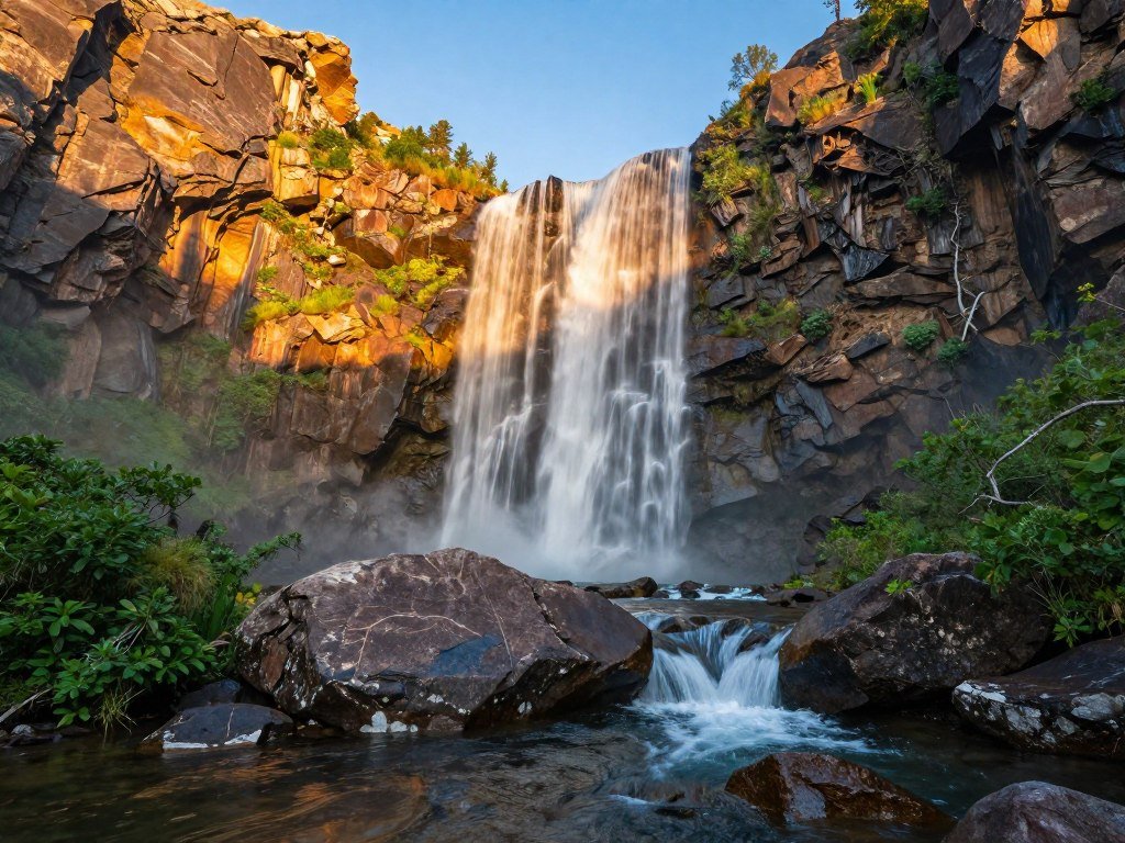
Three Sisters Falls near Descanso
Among the best hiking trails in California for waterfall scenery, Three Sisters Falls stands out for its pools and rugged canyon setting. January through April is the best season for water flow.
The route descends toward the falls, then sends you back up about 1,000 feet of steep, unshaded ground. That return climb can feel especially tough after time near the water.
Access starts at the Boulder Creek Road trailhead, reached by a rough dirt road. The drive and climb make this a strenuous outing, not an easy waterfall stroll.
Waterfall routes around Los Angeles
For Los Angeles waterfall hikes, Eaton Canyon and Sturtevant Falls are familiar options. The San Gabriel Mountains also offer mountain hiking near the city, with routes that trade pavement for hills and canyon paths.
Los Angeles hikers can find both waterfall trails and mountain hikes in the surrounding area. Eaton Canyon is a clear choice when you want a named waterfall route, while Sturtevant Falls brings you into the forested foothills.
Check the route’s current conditions before setting out, since water flow and trail access can affect the experience. Reserve the required day-use permit before driving to the Boulder Creek Road trailhead.
Which Colorado Hikes Have the Best Alpine Views and Water?
Lake Isabelle is the gentlest of the measured alpine options, while Ice Lakes Basin and Island Lake make the strongest hard-hike choice. Blue Lakes offers a middle path, with a shorter lake visit and a much harder extension.
Choose a route based on your planned endpoint, because gaining a pass can change the hike’s difficulty. These Colorado choices pair alpine water with different levels of distance and climb.
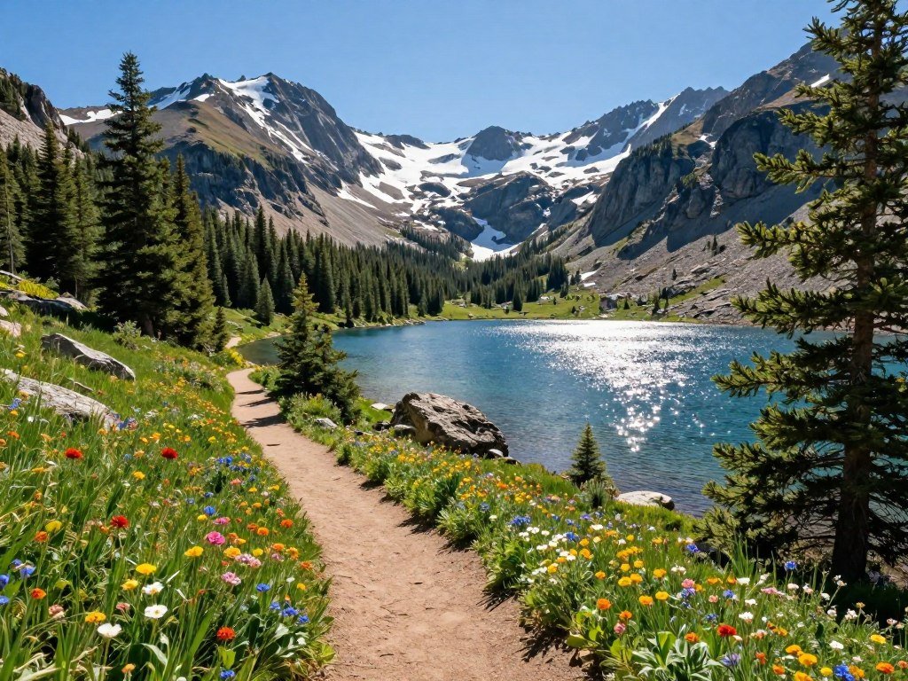
High-country lakes and basin routes
Blue Lakes covers 7 miles round trip to the lower lake and about 9 miles to the upper lake. The full hike gains 2,500 feet, and continuing to Blue Lake Pass and Mount Sneffels makes it hard.
Lake Isabelle is 4-5 miles with 400 feet of elevation gain, rated easy to moderate. That makes it a gentler choice when you want alpine water without a steep, high-effort day.
| Trail | Distance | Elevation gain | Difficulty |
|---|---|---|---|
| Blue Lakes | 7 miles lower lake; 9 miles upper lake | 2,500 feet full hike | Moderate to lakes; hard to pass and Mount Sneffels |
| Ice Lakes Basin and Island Lake | 9.5 miles | 3,000 feet | Hard |
| Columbine Lake | 7 miles | 2,500 feet | Hard |
| Lake Isabelle | 4-5 miles | 400 feet | Easy to moderate |
| Missouri Lakes and Fancy Lake | 10 miles | 2,900 feet | Moderate to more challenging |
Ice Lakes Basin and Island Lake packs 3,000 feet of elevation gain into 9.5 miles. Columbine Lake is another hard option, with 2,500 feet of gain over 7 miles.
Missouri Lakes and Fancy Lake makes a longer outing of 10 miles and 2,900 feet of gain. For a shorter water-focused hike, Mohawk Lakes reaches its farthest lake in 9 miles, with 2,100 feet of gain.
For a forest-and-water outing, Maxwell Falls offers a different feel from the high alpine basins. It can suit you when you want a wooded route rather than a high-country lake day.
Longer routes for a full-day challenge
Sky Pond in Rocky Mountain National Park covers 8.5 miles and gains 1,800 feet. It is rated moderate to hard, so the distance alone does not tell the full story.
The Four Pass Loop near Maroon Bells stretches 30 miles. Snowmass Lake via Buckskin Pass covers 20 miles, making both routes much larger goals than a single lake visit.
These longer routes ask for more time on the trail and a larger effort across the day. If you want Denver-area hikes with water, Blue Lakes and Sky Pond offer distinct lake settings, while Mohawk Lakes gives you a route to several lakes.
Match the route to the highest point you plan to reach, since a lake trail can become substantially harder when extended to a pass.
Where Can You Find Scenic City-Edge Hikes?
Colorado Springs pairs short, low-gain walks with longer climbs, so a scenic outing does not have to mean an all-day alpine hike. Garden of the Gods has free entry and trails from 0.5 to 3.5 miles round trip.
The park’s routes gain up to 300 feet, while Mount Muscoco climbs 1,292 feet. That range lets you choose a short stroll or a more demanding city-edge hike.
Colorado Springs trails for different energy levels
Garden of the Gods offers a flexible setting for a quick walk among striking rock formations. Its short routes keep the outing manageable when you have limited time or mixed experience in your group.
Helen Hunt and Silver Cascade Falls is a 0.6-mile round trip with 298 feet of elevation gain. It is the short waterfall outing in this group, with a climb packed into a small distance.
Mount Muscoco covers 4 miles round trip and reaches an 8,020-foot summit. Seven Bridges Trail runs 5.7 miles, gains 1,597 feet, and crosses seven bridges along the route.
For a flexible walk, use the free Garden of the Gods entry, then choose a longer route only if the added elevation suits your group.
Los Angeles trails for mountain and waterfall scenery
Griffith Park is a convenient Los Angeles hike when you want city access and open views. The Santa Monica Mountains offer a broader mountain setting for longer hikes outside the urban core.
For waterfall routes around Los Angeles, Eaton Canyon and Sturtevant Falls are familiar choices. The San Gabriel Mountains add mountain scenery and trails within reach of the city.
Other scenic areas across the country include Tanyard Creek Nature Trail and Big Bluff Goat Trail in Arkansas. Oregon’s Columbia River Gorge and Silver Falls State Park are also known for waterfall and forest routes.
If you want a nearby park for a casual walk or family outing, explore parks with walking and hiking trails that fit your location.
Which Kentucky Trails Suit a Scenic Day or a Longer Challenge?
For sheer endurance, the Sheltowee Trace is the clear Kentucky challenge among these two long trails. It runs over 330 miles from north of Cave Run Lake to Burnt Mill in Tennessee.
The Sheltowee Trace is Kentucky’s longest trail, while Pine Mountain State Scenic Trail offers a 42-mile alternative. Choose a specific stretch based on how much time you have and what terrain you want.
Sheltowee Trace for a long-distance goal
The Sheltowee Trace Association lists the trail at 343 miles in 2025. Its length makes it the strongest endurance test among these featured Kentucky choices.
The trail crosses forest and varied ground, so a short segment can feel very different from a multi-day trek. Its full distance is a long-term goal, not a reasonable single-day plan.
Pine Mountain for a shorter trail commitment
Pine Mountain State Scenic Trail is 42 miles long and offers a scenic choice for hikers who want a shorter long-distance route. It is not an objective winner for every visitor; the best fit depends on your plans and preferred scenery.
- Distance: Pick a segment that fits your available day or trip.
- Terrain: Check the route’s hills and trail surface.
- Access point: Plan where you will start and finish.
The hardest individual day hike depends on the segment and current conditions, not total trail length alone. A steep section can demand more than a longer stretch with gentler grades.
Choose a specific segment before setting out, rather than treating a trail’s full length as a single day hike.
What Are Some Good Hiking Trails Around Nashville?
Nashville’s options range from a strenuous 12-mile route to a roughly 1-mile loop. Laurel Woods Loop at Beaman Park is the demanding pick, while Warner Park has a short route for an easy outing.
Laurel Woods Loop is strenuous, and its 6-mile cut-through gives you a shorter way through the park. Mossy Ridge also asks for steady effort because it has sustained hills and technical terrain.
Sustained climbs and technical terrain
Laurel Woods Loop covers 12 miles at Beaman Park. It is a strong choice for a strenuous Nashville hike, especially when you want a longer day on wooded ground.
Mossy Ridge Trail at Warner Park is 4.9 miles, with sustained hills and technical terrain. Its shorter distance does not make it an easy walk, since the route keeps asking your legs to climb.
Radnor Lake Trail combined with South Lake Trail makes a 3.2-mile loop. Ganier Ridge Trail is a hilly 1.65-mile route that joins the Lake Trail.
Dogs are not permitted on any Radnor Lake trails. That rule applies across the trail system, including the routes around the lake.
Short loops and easy ways to get outside
For a short Nashville walk, combine Hungry Hawk Trail with Little Acorn Trail at Warner Park. The two paths make an approximately 1-mile loop.
Shelby Bottoms has five trails and five miles of paved multiuse paths. The paved routes offer a different surface from wooded park trails and can suit a relaxed walk.
Harpeth Woods Trail is a 2.5-mile loop for a moderate-length outing. The mix of lengths around Nashville makes it easier to choose a route that fits your time, not just your fitness.
Leave dogs at home for any Radnor Lake trail, since the restriction applies throughout the trail system.
How Can You Prepare for a Safer Day Hike?
A few checks at home can prevent a route-finding or hydration problem from turning a good hike into a stressful one. Start with current conditions, since weather and trail closures can change your plans.
A useful hydration rule of thumb is about 1 liter of water for every 3-4 miles hiked. Bring more for heat or strenuous terrain, and carry snacks for the day.
- Check the current official map and trail conditions.
- Carry a printed map as a backup to phone navigation.
- Pack layers, snacks, and enough water for the route.
- Confirm parking, restroom, and seasonal access details.
Phone maps depend on battery life, so a paper map gives you another way to follow the route. Keep noise low, stay on marked trails, and pack out your waste.
The Texas Parks & Wildlife hiking guidance also recommends food, water, suitable clothing, a flashlight, and a trail map.
Packable rain pants can help when the forecast may shift, and a good pair should balance breathability, fit, and weight. Compare waterproof hiking pants for rainy trails before choosing a pair to carry.
Tell someone your route and expected return time before heading into an area with limited cell service.
Keep that person updated if your plan changes, especially when you take a different trail or return later than expected.
Conclusion
The right hike is the one that fits your location, experience, and available day. Choose by region and ability, then treat current route conditions as part of the decision.
You do not need a major trip to get outside; a nearby loop can still make a good day in nature. Pick one trail, check its official access information, and set a start time that leaves room for the route.
Choose one route, verify access with the land manager, and put a start time on your calendar.
FAQ
What are some must-do hikes in Colorado?
What are some good hikes around Nashville?
What are the big 3 trails?
What are some good hiking trails in Kentucky?
What is the most breathtaking place to visit in Kentucky?
What is the longest hiking trail in Kentucky?
How long is the 3 Sisters Falls hike?
How hard is the Stairway to Heaven hike?